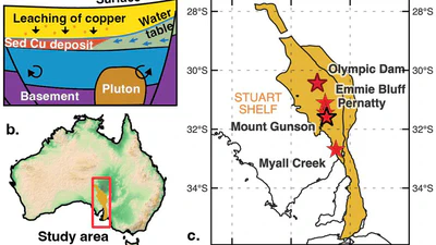
Tracing ancient groundwater to discover copper
An update on the 'Go with the flow' project — an ARC Industry Research Fellowship with BHP that combines continent-scale groundwater modelling with copper exploration to find new …

I am an ARC Industry Research Fellow in the School of Geography, Earth and Atmospheric Sciences at The University of Melbourne. I am an expert in fusing Earth evolution models with data to understand how groundwater moves critical minerals through the landscape. Related research interests include the cycling of volatiles within the Earth, probabilistic thermal models of the lithosphere to unravel past tectonic and climatic events, and understanding the how enigmatic volcanoes form.
I am a vocal advocate for the integral role of geoscience in responding to challenges we face in transitioning to the carbon-neutral economy. As an expert in my field, I have been interviewed in national and international print media, TV, and radio on a wide variety of subjects including earthquakes, volcanoes, groundwater, and critical minerals.
An update on the 'Go with the flow' project — an ARC Industry Research Fellowship with BHP that combines continent-scale groundwater modelling with copper exploration to find new …

Use cutting-edge tools to appraise exploration uncertainty
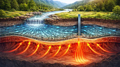
Simulate fluid and heat transfer within the Earth

Interrogating plate reconstructions to target mineral deposits using AI
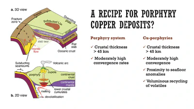
“With copper demand projected to increase by 350% by 2050 for renewable energy and electric vehicles, understanding the formation of porphyry copper deposits is critical. We …
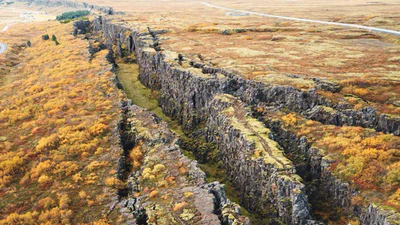
New research published in Communications Earth & Environment shows that the balance between volcanic outgassing and carbon sequestration into oceanic lithosphere is the key driver …
Carbon emissions along divergent plate boundaries modulate icehouse-greenhouse climate transitions through mid-ocean ridge and rift degassing.
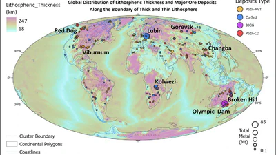
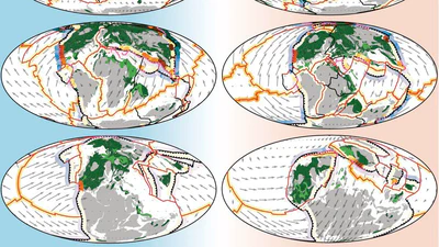
Our new paper in Geoscience Frontiers uses full-waveform seismic tomography and machine learning to map craton boundaries worldwide — and shows that 85% of target mineral deposits …

Using full-waveform seismic tomography to detect craton boundaries and their spatial links to critical metal deposit locations.

Why I've moved from Dask to Ray for distributed raster processing, and why Zarr is the natural storage format to pair with it.